‘Memories of East Texas …’
Well, South Texas and West Texas anyway. ‘Memories of East Texas…’ is the Michelle Shocked song.
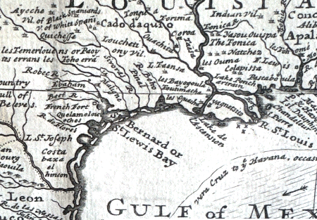
The section of antique map pictured above, by late 17th- and early 18th-century geographer Herman Moll, depicts the coast between the St. Lewis Bay and the ‘Rive St. Louis’ (currently known as the Mississippi River, although perhaps in honor of the general idea of kings and to spite President of France Emmanuel Macron, Trump will rename it after the famous French King).
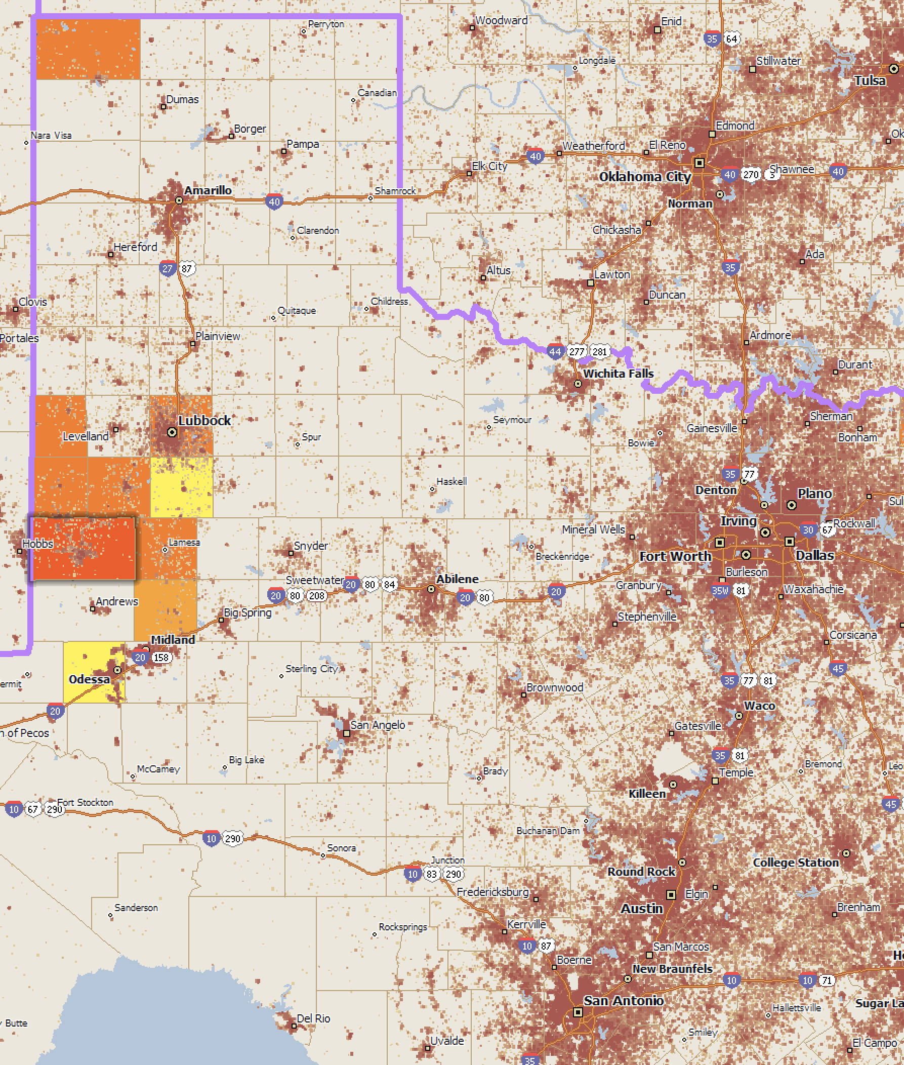
Meanwhile, on the Texas Measles Outbreak 2025 webpage, I found a current data source for the counties with measles (there are also 6 other 2025 cases in Texas that are independent of this multi-hundred-case West Texas outbreak). There’s an interactive map there, and you can fly your mouse over the map & it will show the county name & measles count.
Well, I did go to the trouble of merging this data which is ‘keyed’ by county name with my own export of current-year estimates (‘df’). I wanted to see a bar chart showing the percentage of each county’s total pop who has measles. Not too exciting, so … not shown. In Gaines County it was just over 1 percent, an increase from just under 1 percent last month. Uh-oh. Still, the rest of Texas with six cases versus an unvaccinated area with over 400.
# How I merged the cases dataframe ('df') with my existing county data

merged_cases <- df |>
  right_join(cases, by = c("county_name" = "County"))
So, I don’t think that needs to be duplicated here.
But, I did like the other aspect of a map I made, in which you can see how sparsely populated West Texas is. The data containers in this map, Scan/US Microgrids, only appear in areas where there are housing units. Everywhere else is just the lonesome prairie.

That’s right, there are NO HOUSES in those vast areas of Texas where you think – and you’re right – that no one lives.
If you search in Apple maps for ‘Fort St Louis’, which I read about in Tim Severin’s book ‘Explorers of the Mississippi’, you may find in Texas the ‘Ft. St. Louis Cemetery’ which has a link to Historic Ft St Louis where you may see another antique map of Texas, this one in French. Settled briefly during La Salle’s tragic expedition to find the mouth of the Mississippi (They sailed past it, landed, then kept going west away from the river), Fort St Louis was the first French settlement in Texas. If you search in Google maps, you may find photographs the historical marker and some photographs of the cannons that were unearthed there at some point.

[Arc de Honda]
— all photos Copyright © 2022-2024 George D Girton all rights reserved